You are here
ARviewer SDK
ARviewer is a FLOSS mobile augmented reality browser and editor that you can easily integrate in your own Android applications.
The browser part of ARviewer draws the label associated with an object of the reality using as parameters both its A-GPS position and its altitude. The system works both outdoors and indoors---in this latest case with location provided by QR-codes. ARviewer labels can be shown through a traditional list based view or through an AR view---a magic lens mobile augmented reality UI.
ARviewer is not only an AR browser that draws labels that others have created over the objects of the reality perceived through the camera of the mobile. ARviewer can also be used to create and upload content, enabling throwdown applications such as FourSquare or social game applications to create and associate labels with a latitude, longitude and altitude from the mobile.
By integrating ARviewer in your Android applications you can easily extend them with the following features:
- Show all your multimedia information in AR view (pictures, audio, video and notes)
- Advanced AR interface using latitude, longitude and altitude
- Advanced Navigation and Search mode
- Intuitive summary information boxes
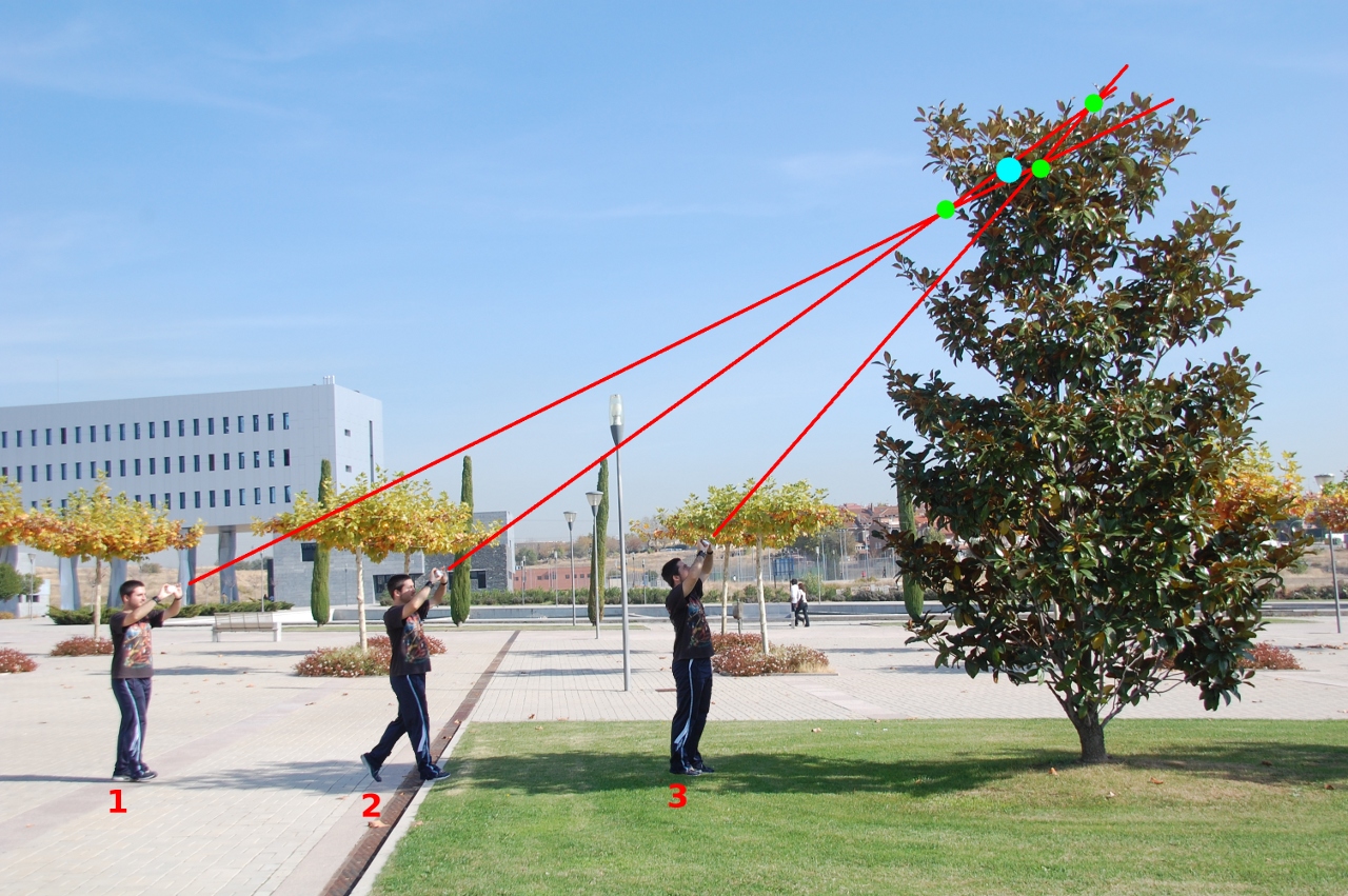
- Labeling objects at different altitudes from the mobile
How to integrate ARviewer (as a browser) in your Application
- Download ARviewer from Android Market
- Download ARviewer SDK and add it to your Android project
- Write a GeoNode struct wrapper for your data
- Invoke ARviewer App with ArrayList. You need to send the GeoNodes in a Layer struct alongside its current longitude, latitude (and altitude if known).
It's really simple, as you can see in the following example:
mylayer = new GenericLayer(0, "", "My Layer", "Description",
                           null, null, null, null, null, null);
mylayer.setNodes(mNodeList);

Intent intent = new Intent("com.libresoft.apps.ARviewer.VIEWER");
intent.putExtra("LAYER", mylayer);
intent.putExtra("LATITUDE", getCurrentLocation().getLatitude());
intent.putExtra("LONGITUDE", getCurrentLocation().getLongitude());
startActivity(intent);
How to integrate ARviewer (as an editor/content creation tool) in your Application
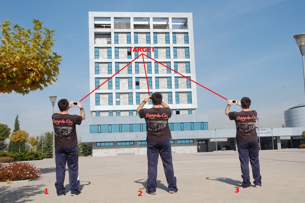
The labeling mode of ARviewer allows to label geopoints using the data provided by mobile the acelerometers, digital compass and A-GPS. When ARviewer is invoked in this mode the user can label as many points as he wants. When the control returns back to your application you receive an ArrayList of GeoNodes with all the information the user created.


To use the ARviewer as an editor/content creation tool you must follow the next steps:
- Download ARviewer from Android Market
- Download ARviewer SDK and add it in your android project
- Invoke ARviewer App
Intent intent = new Intent("com.libresoft.apps.ARviewer.LABELER");
intent.putExtra("LATITUDE", getCurrentLocation().getLatitude());
intent.putExtra("LONGITUDE", getCurrentLocation().getLongitude());
startActivityForResult(intent, TAGGING_RES);
- Receive the data
protected void onActivityResult (int requestCode, int resultCode, Intent data)
{
   switch (requestCode) {
     case TAGGING_RES:
        if( resultCode != Activity.RESULT_CANCELED )
        {
           mNodeList = () data.getSerializableExtra("LABELED_NODES_LIST")
           .sort(mNodeList, new GeoNodePositionComparator());
        }
      break;
    }
}
Resources
- Download applications from the Market: https://market.android.com/search?q=arviewer
- Source Code and GIT repository of ARviewer: http://git.libresoft.es/ARviewer
- Source Code and GIT repository of ARviewerPlaces: http://git.libresoft.es/ARviewerPlaces/
- Source code and GIT repository of ARviewerTagging: http://git.libresoft.es/ARviewerTagging/
Theme by Danetsoft and Danang Probo Sayekti inspired by Maksimer
